LifeScienceHistory.com - Check us out on Instagram
Take Your Next Career Step with Lundback
Geography & Climate
Industry
Snapshot | Economy/Cost of
Living
Education
| Recreation
& Entertainment | Transportation
History | Suggested
Reading List
 Alberta is located in the southwestern region of Canada. It contains 661,190 square kilometers (260,000 square miles or 66,119,000 hectares) of total area. Alberta is bordered to the west by British Columbia, to the north by the Northwest Territories, to the south by the United States border, and to the east by Saskatchewan.
Alberta is divided geographically by the Rocky Mountains and their foothills, the Saskatchewan Plain, the Alberta Plain, and a portion of the Canadian Shield. Alberta’s highest point is Mt. Columbia at 3,747 meters (12,294 feet).
A great variety of lakes lie within Alberta, such as mountain lakes, boreal forest lakes, and shallow lakes on the prairie. Major rivers in the Princess Province include the Athabasca River, the Slave River, the Peace River, the North and South Saskatchewan Rivers, and the Hay River, along with many additional tributaries.
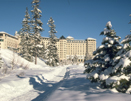
Alberta’s climate varies due to topography and latitude. The province is primarily dry, particularly in the southern portion, due to the rain shadow effect of Pacific Ocean air masses passing over the Rocky Mountain peaks, which trap much of the moisture. The most extreme climate region of Alberta is to the north, which is characterized as sub-arctic. Central Alberta is defined as having a continental climate. Southern Alberta’s climate is more moderate and semi-arid. The average daily temperatures in July range from 16 degrees C (60.8 degrees F) in the northern region to about 21 degrees C (69.8 degrees F) in the southern region. January temperature averages range from about -14 degrees C (6.8 degrees F) to -9 degrees C (15.8 degrees F). Precipitation averages from 40 to 45 centimeters (15.7 to 17.7 inches) annually in the north, 55 to 60 centimeters (21.7 to 23.6 inches) in the foothills, and 30 centimeters (11.8 inches) to the southeast. The province therefore experiences many sunny days, lending the province an additional nickname: the "Sunshine Province."
The Chinook winds are an interesting feature of Alberta’s weather patterns. In winter and early spring, these occasional warm winds blow in from the west, causing temperatures to rise rapidly. The winds can blow for several days, melting snow and giving temporary relief from the bitterly cold winters.
Related Resources:
Back to Destination Alberta